2013 Trans North Asia Overland Trip GPS Track Logs
THAT was one hell of a drive!
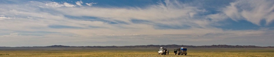
So we completed our trip to Vladivostok back in late September last year and we are still working on the last two blog posts for you (thank you for your patience). In the meantime check out our 42,000km GPS track log.
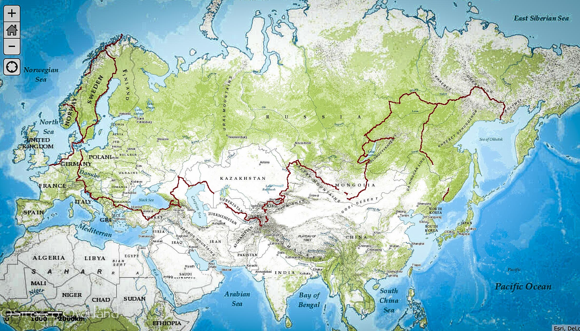
With the use of our daily tracklogs from our Garmin GPS our GIS man (Jack Pitts) back home has pinned together our route from the moment we landed in France, to putting the 90 in the container.
After 10 months (248 nights) on the road totalling 42,000Km we have crossed 22 countries, 16 International border crossings, survived temperatures from -25 to +35 degrees C and camped for 176 nights.
Check out our Interactive Map here: Progress So Far
There are a few gaps in the tracklogs which we are still working on.
Enjoy.
Photo of the Week: Bush Camping, Mali – West Africa 2011
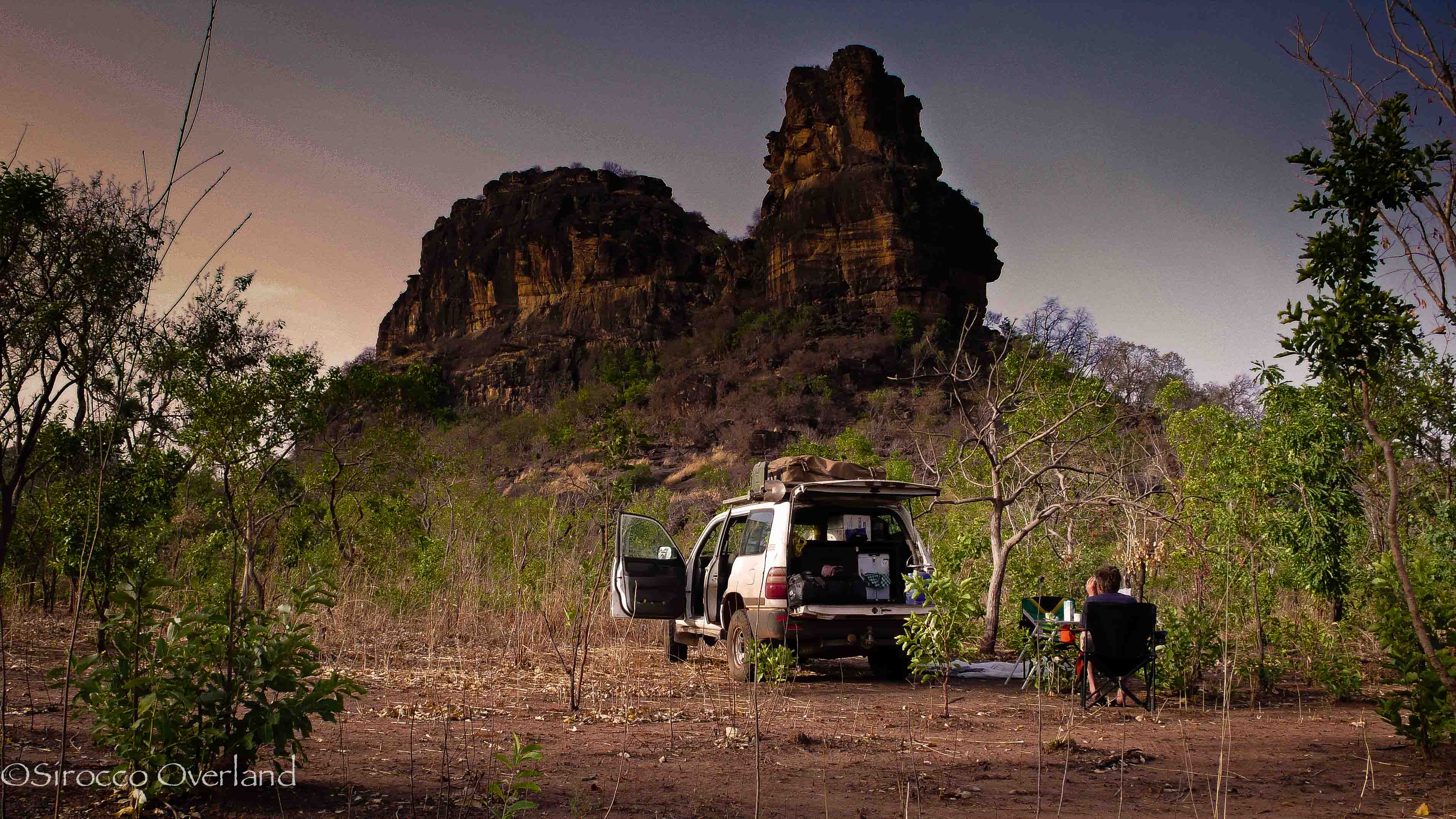
Southern Mali Bush Camp
One of the most memorable photos from my time in West Africa was this camp spot in the far southwest of Mali.
We were hundreds of kilometres off the bitumen trying to map routes through the Bafing National Park. We followed tracks to the Bafing Chimpanzee Santuary which turned out to be completely shut down, it had been closed many years previously but we were in the area so had to check it out. We followed some feint tracks south from there which petered out from village to village. Each one we passed through we were greater warmly by the people. After 150km we were pretty deep and we knew our fuel supplies would be pushed to the limit (with 2 leaking tanks and running the 6cyl petrol). To top it off the clunk from the driveline got worse (turned out to be a front prop UJ) so we decided that night to turn tail and head back to refuel. We had mapped what little we could.
That night we heard some rustling around camp which turned out to be a stray cow. We could however hear in the distance a lot of chanting, singing and wailing. Maybe witch doctors are alive and well near the Guinean border after all.
——————————————————————————
To read more about the MAPA Project and our adventures there, take a look here:
West Africa, MAPA Project 2011
5 months on the road – Progress So Far…
With the use of our daily tracklogs from our Garmin GPS our GIS man (Jack Pitts) back home has pinned together our route from landing in France (I don’t need a GPS to find Dover from Swansea 😉 ) to Bishkek in Kyrgyzstan.
After 5 months (147 nights) on the road totalling 24,000Km (15,000 miles) we have crossed 22 countries, survived temperatures from -25 to +35 degrees C and camped for 102 nights.
check out our Interactive Map here: Progress So Far
There are a few gaps in the tracklogs which we will work on to iron out for the next stage of the mapping progress.
Enjoy.